Map of Ticino districts. (Photo credit: Wikipedia)
The southernmost canton of Switzerland is Ticino. It has 8 districts and borders the Canton of Uri (to the north), Valais (to the west), Graubünden (to the northeast) and Italy’s regions of Piedmont and Lombardy to the south (and it has a small Italian exclave, Campione d’Italia).
In Ticino, named after the Ticino river, which flows through it from the Nufenen Pass to Lago Maggiore. Italian is the official language (like in southern sections of Graubünden).
Tisino is split geographically in two parts by the Monte Ceneri pass. The Sopraceneri – in the north – is formed by two major Swiss valleys around Lago aggiore: Valle del Ticino and Valle Maggia. The region around the Lago di Lugano is the southern part, also called Sottoceneri.
Its nickname “Sonnenstube der Schweiz” comes from the 2,300 sunshine hours the canton receives every year, compared to 1,700 for Zurich. But Ticino is also “prone to fierce storms and has the highest level of lightning discharge in the whole of Europe”.
If you are interested in hiking in Ticino, Ti-Sentieri is a very good site to plan your journey.
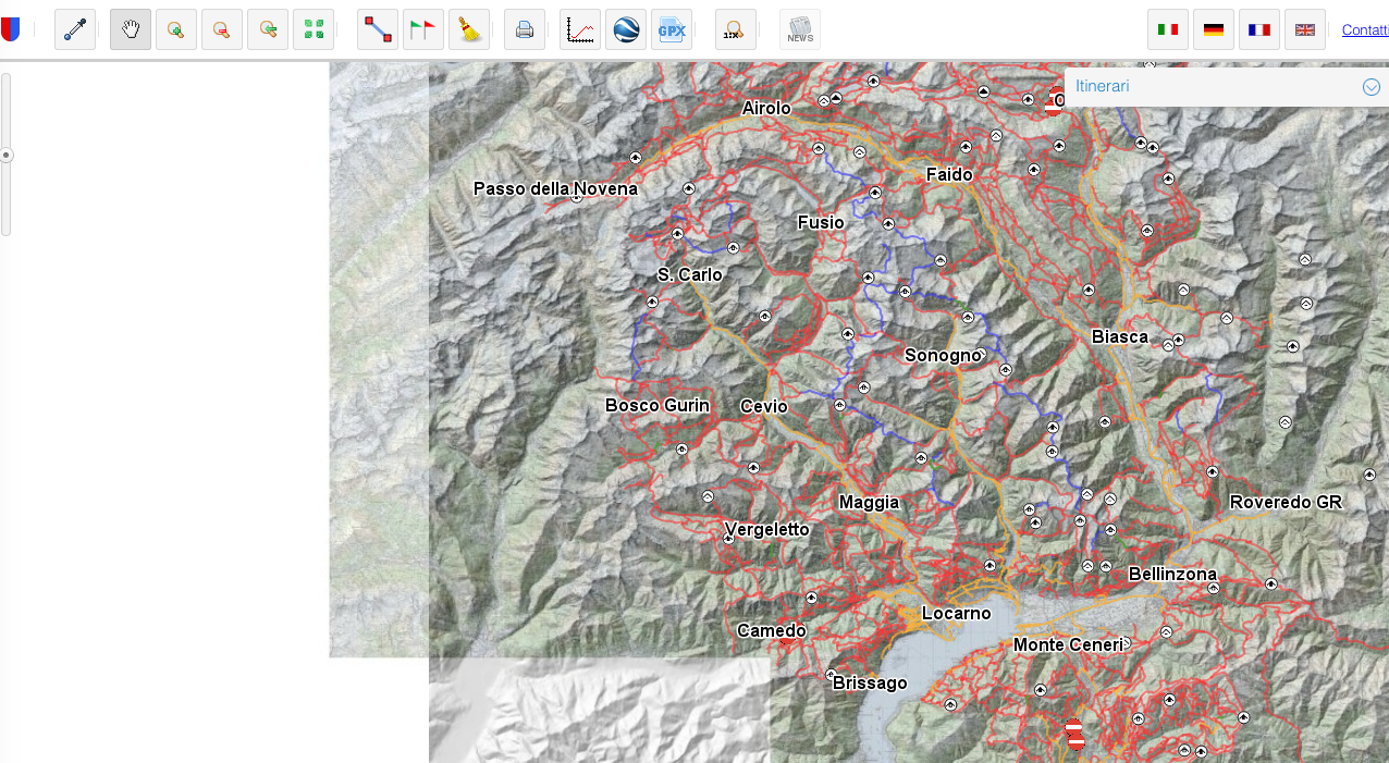
You can choose to start by one of the valleys, choose an intinerary and check the huts (capanne). On the site Capanneti.ch you can have a look at the different huts available.
Make sure that before your first hike you gather all the information you need, by visiting Ticino-Sentieri , where you can find emergency numbers, the kind of roadsigns you’ll find on your path (segnaletica), the rules of conduct (regole comportamentali), and what to do before you start your hike.
Categories: Being expat, Expat Life, Holidays, Switzerland, Travelling